Antiques, Curios, Collectables, Taxidermy, Silver, Gold, Stamps, Bronze
Lot 223:
Description
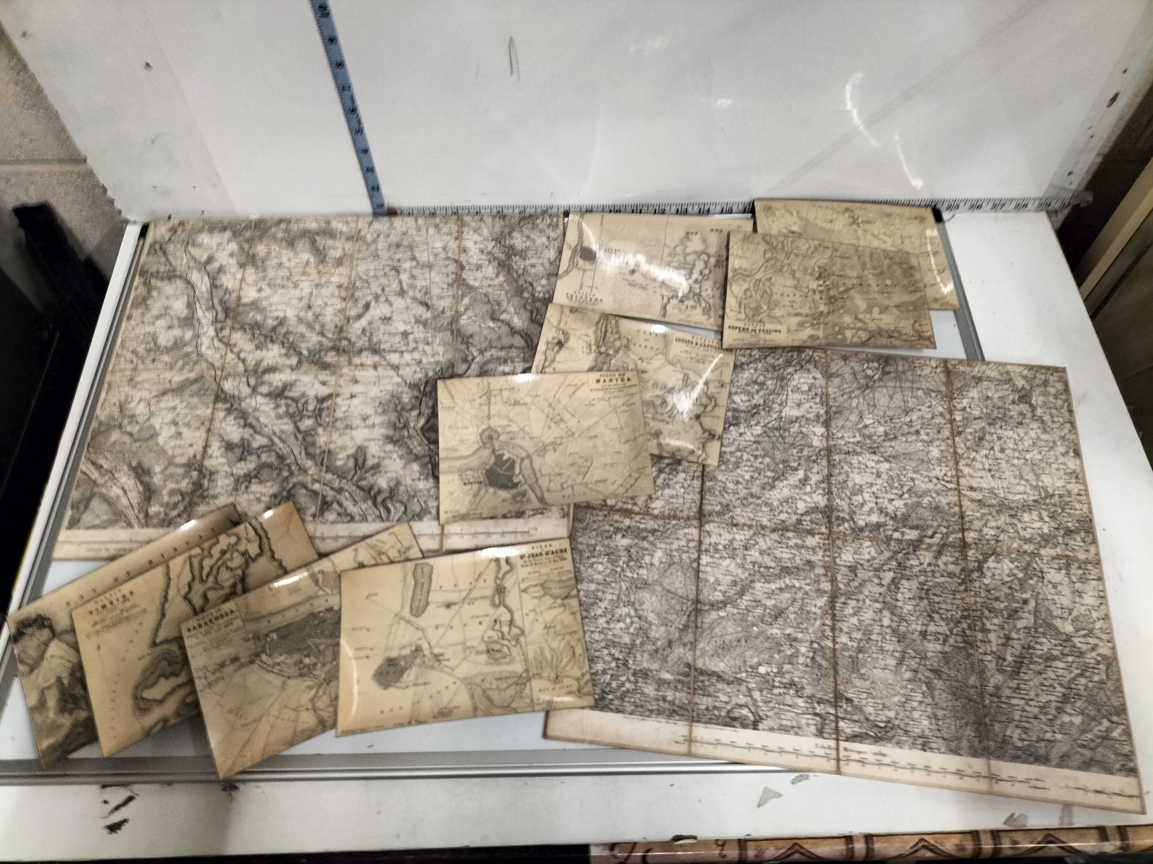
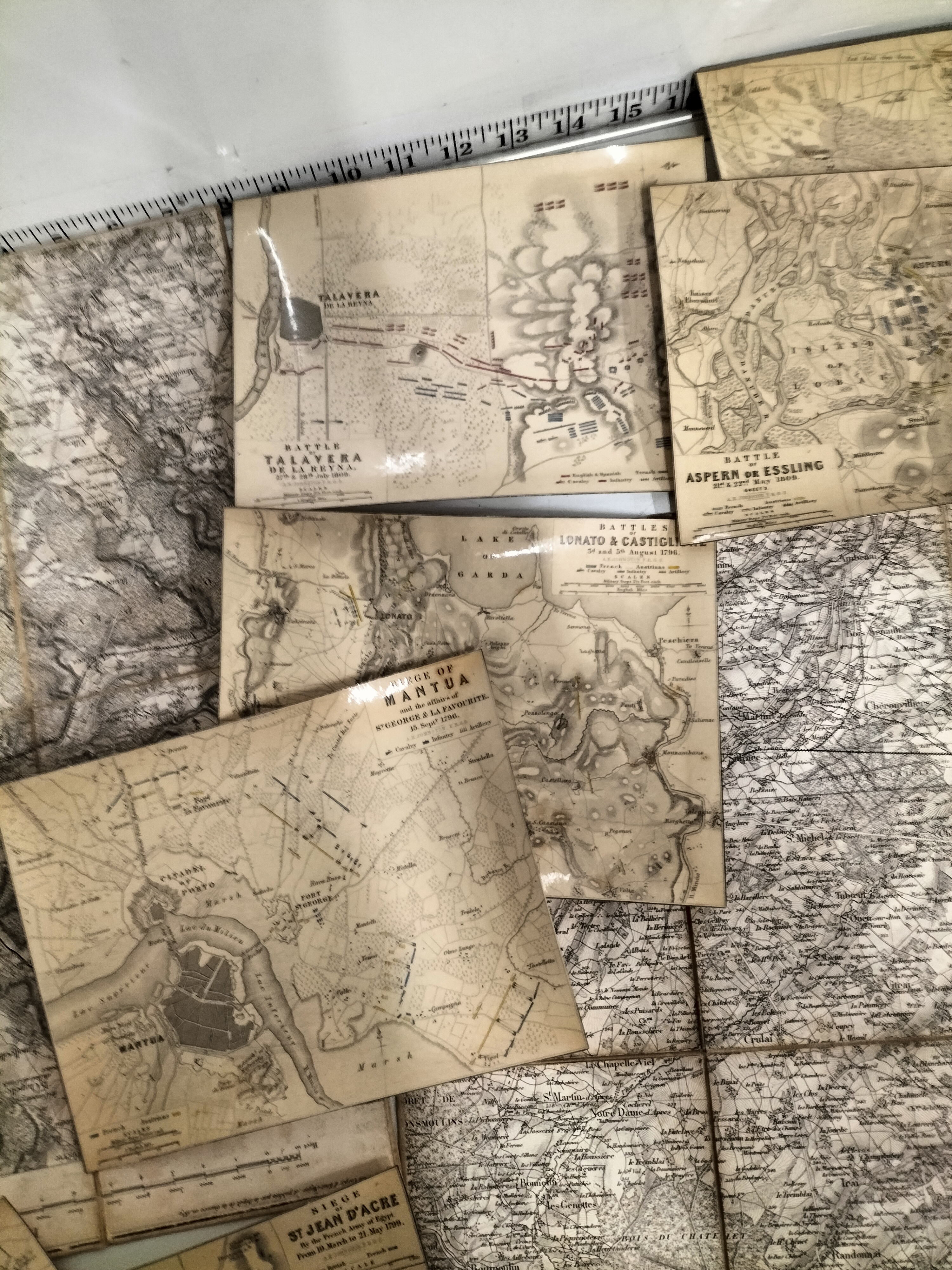
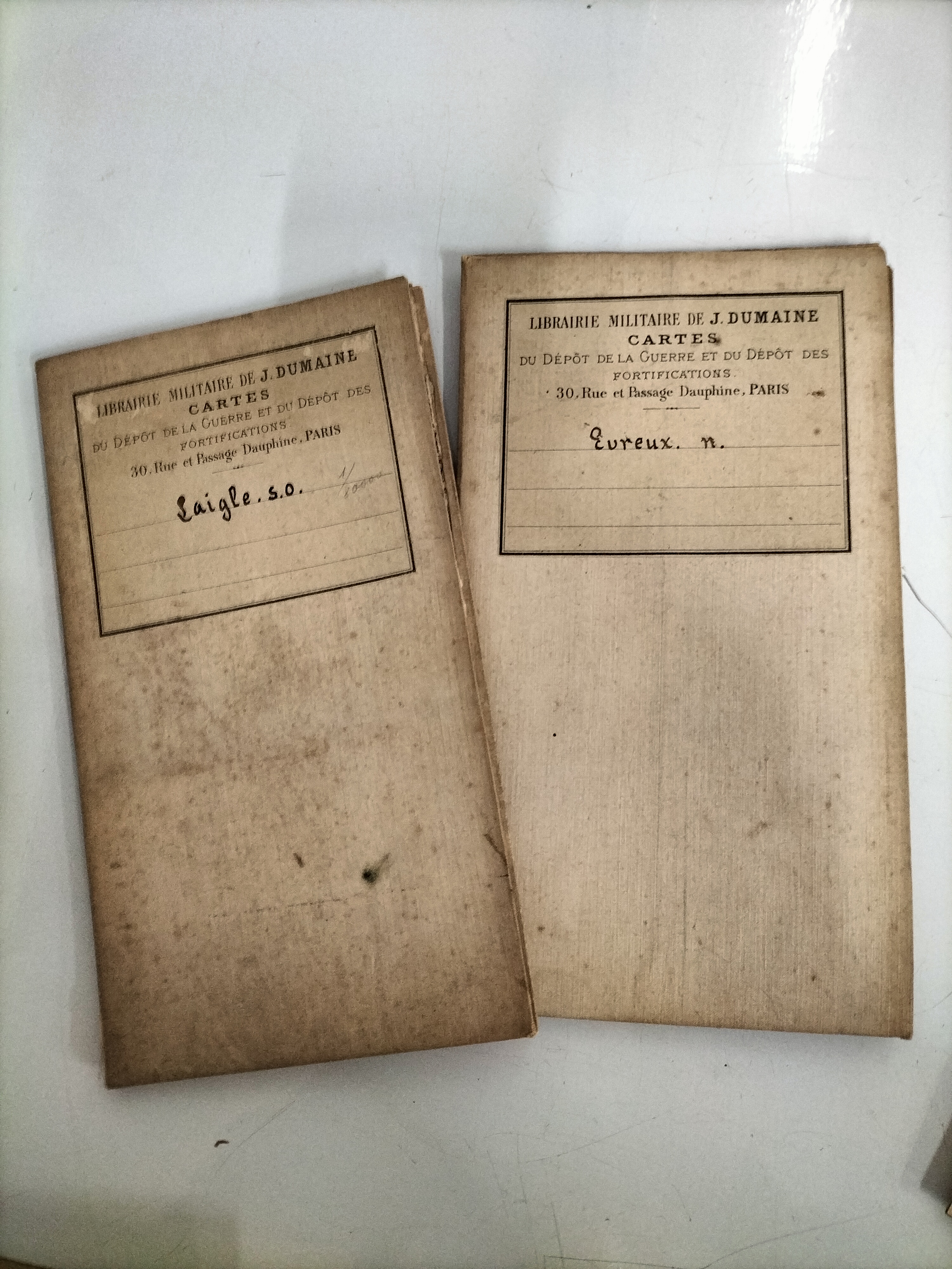
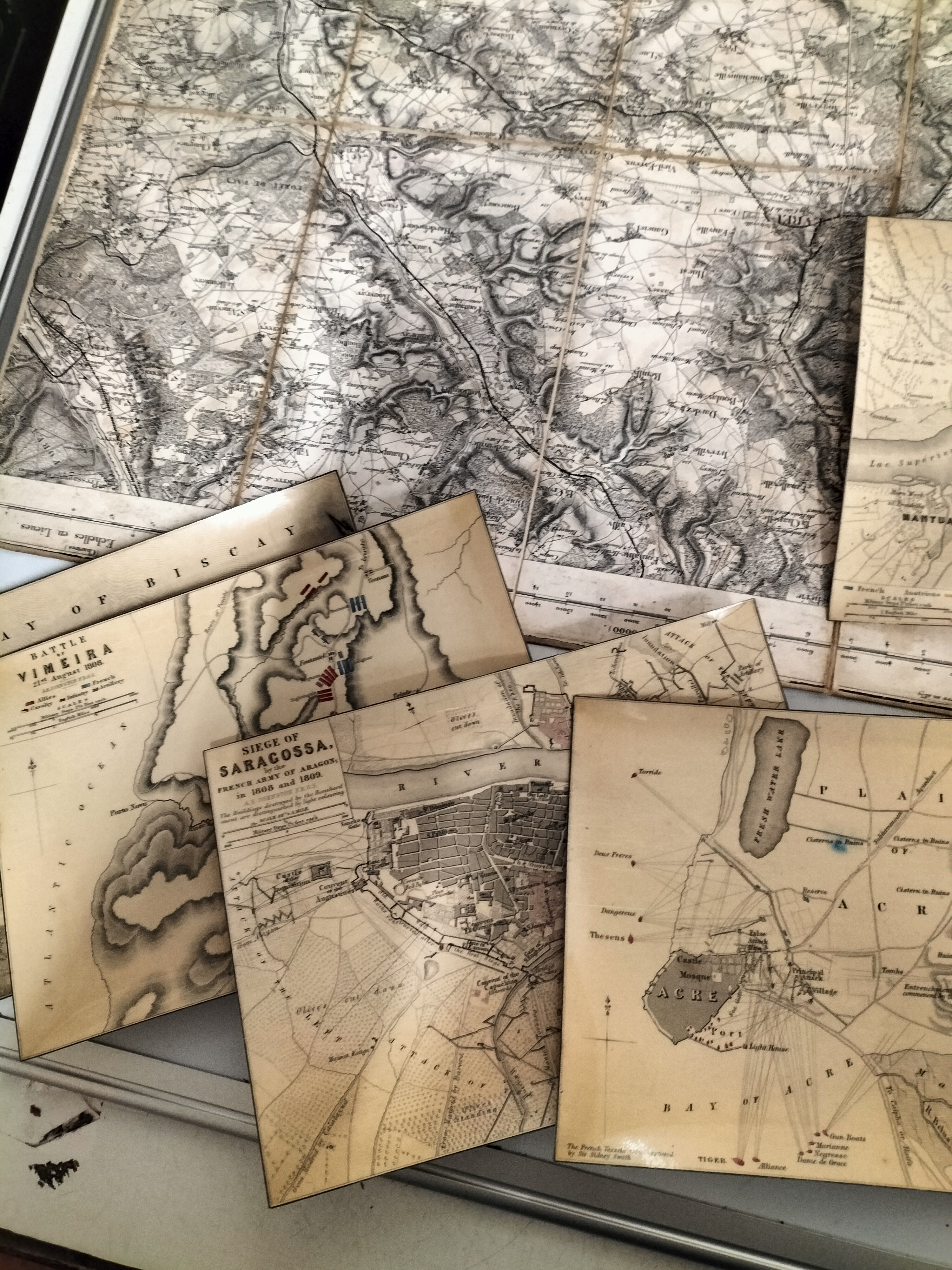
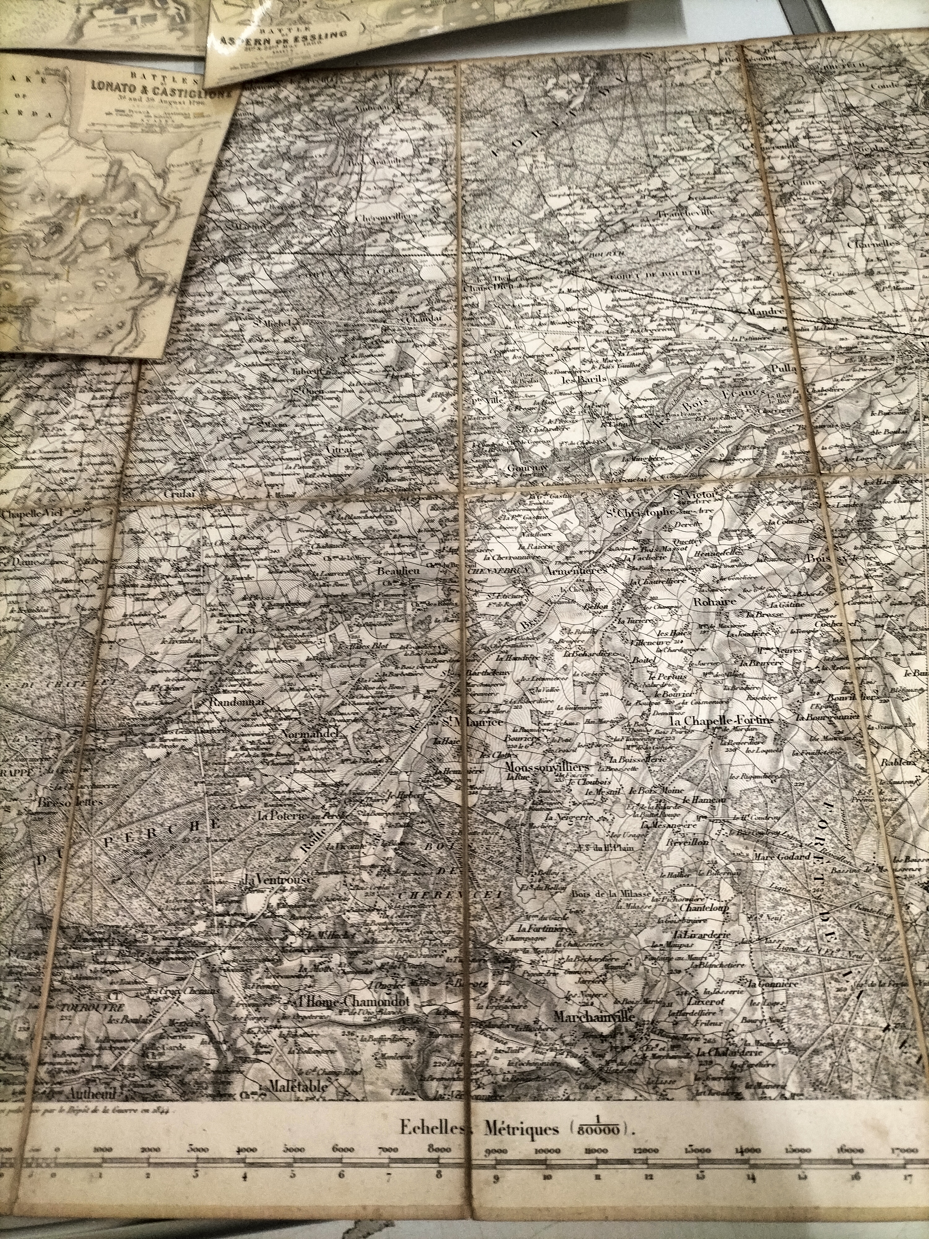
A diverse group of military cartography primarily issued by the Librairie Militaire de J. Dumaine, 30, Rue et Passage Dauphine, Paris, successor to Anselin. These maps were produced for the Depot de la Guerre and the Depot des Fortifications. The collection includes two large-scale engraved topographical maps at a 1:80,000 scale, covering the French regions of Evreux (Nord) and L’Aigle (Sud-Ouest). One map bears a publication date of 1844. These maps are expertly dissected into panels and mounted on linen backing for folding, accompanied by their original printed paper wrappers featuring period manuscript identifications. Additionally, the lot contains a series of approximately eight printed plans illustrating significant Napoleonic engagements, including the Battle of Talavera de la Reyna (1809), Battle of Aspern or Essling (1809), Battles of Lonato and Castiglione (1796), Siege of Mantua (1796-97), Battle of Vimeira (1808), Siege of Saragossa (1808-09), and the Siege of Acre (1799). The battle plans are printed on heavy paper or card, with some featuring a glossy protective finish. J. Dumaine was the preeminent French military publisher of the mid-19th century, making this collection a significant resource for historians of the Peninsular War and Napoleon’s campaigns in Italy and Egypt.
Share this lot: